Keefe Lake Uranium
Leading Uranium Project in the Eastern Athabasca Basin.
LEARN MORE
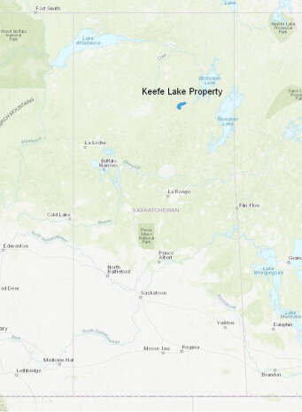
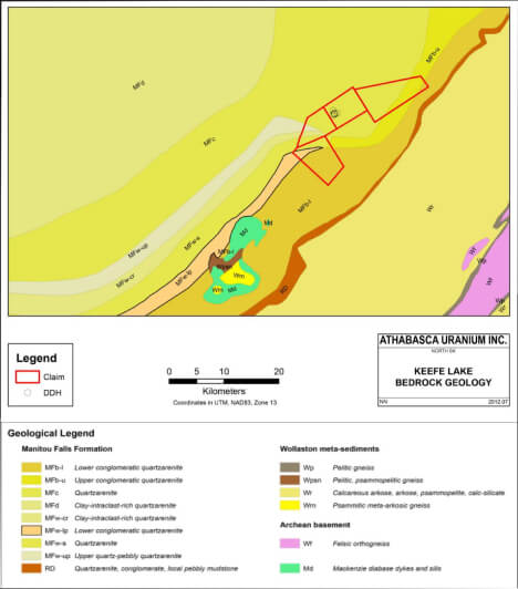
Location
The Keefe Lake Project covers an area of 15,400 hectares, lying within the structural corridor in the eastern Athabasca Basin which also hosts the McArthur River, Cigar Lake and Key Lake mines – the three largest and richest uranium mines in the world.
LEARN MORE
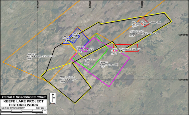
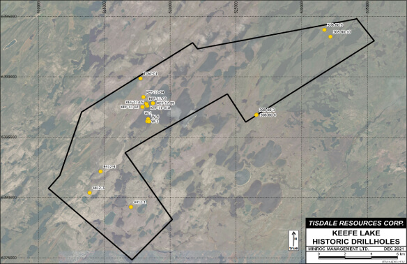
History
Since 2012, Keefe Lake has been subject to over $4 million in exploration expenditures, including airborne geophysics, 2-D seismic and diamond drilling. The Keefe Lake exploration model is a shallow basement or sandstone-hosted uranium deposit, with average basement depths of only 170 meters.
LEARN MORE
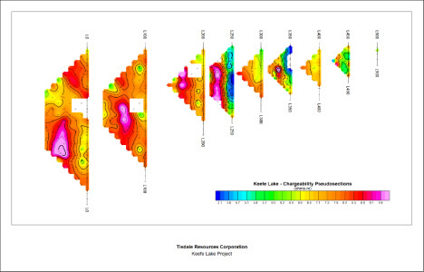
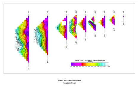
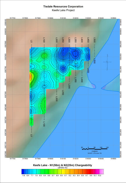
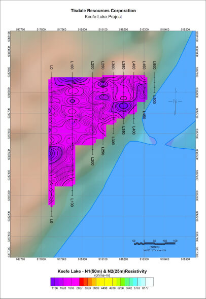
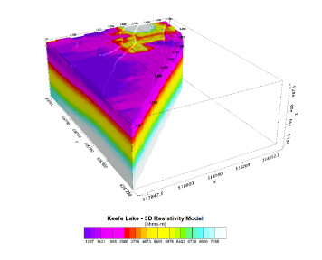
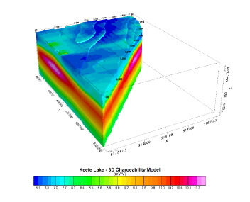
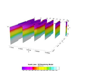
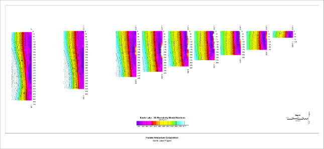
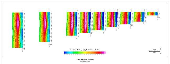
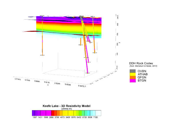
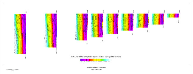
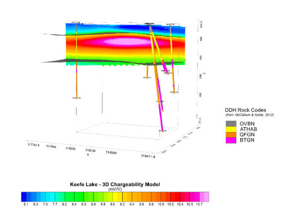
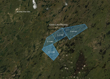
Background
In October 2021, an IP survey over an extremely small area was completed totaling 3.0-line km with 9 lines, entirely within claim S-111007 on the west shore of Keefe Lake. A follow up IP survey was recommended, expanding to a grid of 30-line km total length to improve coverage of the target area. Also recommended, an IP survey within claim S-111008 to assist with selecting targets in this promising area.